Nunthaburi National Park ‘See the romantic sunset.’

Why don’t you ask your girlfriend/boyfriend to see the romantic sunset with you for once in life time? This coming anniversary day, or your holiday, let’s grab his/her hand and do so!
You’re welcomed to Nunthaburi National Park, a place where the sunset looks extremely romantic.
But first, let’s get to know more about the national park. Then we will show you how to see the sunset there.
In 1994, Nan Office of Forestry sent a document to Royal Forest Department, in order to tell how important and gorgeous the woodlands in the area were. Then, two years later, Royal Forest Department sent Mr.Jakkrit Saereenonchai to explore the area, in order to see whether the area was plentiful enough to be a national park or not.
However, Nunthaburi National Park is not an official national park yet. It’s on its way of preparation. But tourists can still get there to enjoy their holidays.
Nunthaburi National Park take places in Tha Wang Pha County, Muang County, and Ban Luang County of Nan Province. The whole area is about 453.31048 square kilomatres. The north connects to Song Kwae County(Nan) and Pong County(Phayao). The south connects to Wiang Sa County(Nan). The east connects to the Highway 1080(Nan-Tung Chang). The west connects to Chiang Muang County(Phayao).
The forests around the national park are very plentiful. There are mixed forest on the west, semi-evergreen forest on the west and the north, montane forest on mountaintops that are about 900 metres higher than the sea level. These aren’t all, but there are still more. There are still limestone mountain forest and meadows. There are many species of trees, including the rare one like teak.


Geography
The geographical features of the National Park consist of high mountains, extending northwards. The National Park is situated in the western part of Nan Province until reaching the Lao People’s Democratic Republic. The site of the National Park is approximately 300-1,674 meters above the medium sea level. The average slope of the site is approximately 50%. Yod Doi Wao is the highest mountaintop of the National Park (at the height of 1,674 meters above the medium sea level).
Climate
Nunthaburi National Park has the tropical weather condition, influenced by the southwestern monsoon during the rainy season and the northeastern monsoon in winter. The weather at the National Park can be divided into 3 seasons including summer (March-May), rainy season (June-October), and winter (November-February). The minimum average temperature is approximately 8.4ฐC and the maximum is 40.8ฐC. The average rainfall is approximately 1,197.6 mm/year.
Flora and Fauna
Major plants in the mixed deciduous forests include teak, Leguminosae (Pradoo), Xylia Xylocarpa (redwood plants), Lagerstroemia (Tabaek), Afzelia Bijuga (Maka), meanwhile, lower plants include different kinds of bamboo.
Major plants in the arid, evergreen forests include Dipterocarpus Alatus (Yang Khao), Dipterocarpus Costatus (Yang Daeng), Malabar Ironwood, Indian Mahogany, Michelia Alba, Mangifera Caloneura Kurz (wild mango), meanwhile, lower plants include different kinds of bamboo, Calamus Caesius, palms, ferns, Caryota urens, etc.
Major plants in the virgin forests include different kinds of Lithocarpus Cantleyanus (Kor), Betula Alnoides Buchham (Kamlang Suerkrong), Podocarpus Wallichianus (Payamai), Benzoin, Cinnamon, Eaglewood, meanwhile, lower plants include different kinds of moss and ferns.

Beside, there are also cute animals running and walking around. There are many types of them, for examples, monkeys, birds, bats, turtles, snakes, frogs, fishes, shrimps, shells etc. They’re mostly small animals.
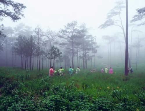
Now, we can talk about seeing the sunset. Well, the most perfect spots are Doi Pha Ji and Doi Pha Chang. These two moutains allow you to see the most romantic sunset ever. Not just the sunset, in fact, but also thick fog during the winter. However, to see the sunset, you have to spend a few nights at the national park, so that you don’t have to travel through the dark to get back to your hotel.
In the national park, there are camping grounds, including on Doi Wao, which allows tourists to set up their tents on its top. Doi Wao is the highest mountain in the national park, about 1,674 metres. You set up your tent there and go to Doi Pha Ji and Doi Pha Chang to see the sunset in the evening. That will be better and safer.
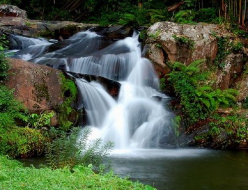
Beside of camping and the beautiful sunset, there are still many waterfalls within the national park that you should visit, for examples, Doi Mhok Waterfall, Tad Fah Rong Waterfall, Song Kwae Waterfall, Huai Prik Waterfall, Santisuk Waterfall etc. Go with your lunchbox and have your lunch at any of these waterfalls. That will be relaxing.


Tourist Attractions in Nunthaburi National Park
Baan Namki Artesian Spring : Baan Namki Artesian Spring is located at Baan Namki, Tambon Phathong, Tha Wangpha District, Nan Province. The Artesian Spring has an approximate temperature of 80ฐC and can potentially be developed as a tourist attraction for mineral bathing.
Doi Mork Waterfall : Doi Mork Waterfall is a beautiful, small-medium sized waterfall located in Tambon Ruang, Muang District, Nan Province, with flowing water throughout the year. The Waterfall is ideal for bathing and recreational activities.
Huai Prig Waterfall : Huai Prig Waterfall is a 4-step, small-medium sized waterfall with flowing water throughout the year. The Waterfall has precipitous streams, reefs, and beautiful cliff sheds. The Waterfall is located in Tambon Baan Pi, Baan Luang District, Nan Province.
Santisuk Waterfall : Santisuk Waterfall is a 5-step, small-medium sized waterfall with flowing water throughout the year. The Waterfall is located in Tambon Saen Thong, Tha Wangpha District, Nan Province.
Song Kwae Waterfall : Song Kwae Waterfall is a small-sized waterfall situated in a virgin forest, which should be developed as a route for natural study. The Waterfall is located in Tambon Sanien, Amphur Muang, Nan Province.
Tad Fa Rong Waterfall : Tad Fa Rong Waterfall is situated in the area of the Pa Namyao-Namsuad National Conserved Forest in Tambon Saen Thong, Tha Wangpha District, Nan Province, which has been surveyed for the establishment of Nanthaburi National Park. The Waterfall is a 3-step large-sized waterfall with flowing water throughout the year and being the source of rivers. Doi Wao mountain range is situated in Baan Namki, Tha Wangpha District, Nan Province, approximately 4 km away from the site of artesian spring.
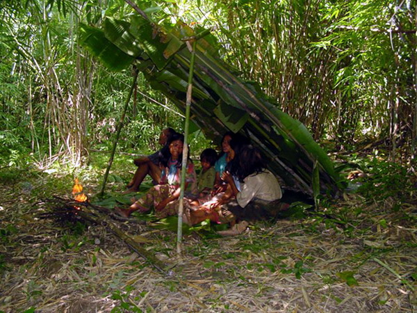
Mlabri or Habitations for Pi Tong Leung Tribe : There are Mlabri tribe people who have been moving from place to place in the jungle. They have been living in their traditional ways in harmony with the nature. Few organizations have been studying their life and at the same time trying to improve their living standard. It is suggested that to let the sustainable progress to take place tourism should not be promoted in the places where these people live.
That’s not the end of that. You can go hiking at the national park too. There are some hiking routes available. However, you have to wait for further details when the national park is debuted officially.
How to get there
In order to get to the national park, first you start your trip in Nan. Look for the Highway 1080(Nan-Tung Chang). Reach for Ta Wang Pha County and switch to the Highway 1148(Wang Pha-Song Kwae). Continue straight for about 1.5 kilometre. Then switch to the Highway 1082(Na Khanun-Sob Khun). After reaching the 27th kilometre, turn right and keep going for another 500 metres. You will reach the national park soon.
For your caution, the road to the national park may not be smooth or convenient enough, as it’s not a full-time national park yet. Therefore, you should drive carefully. On your first trip, it will be best if you bring someone with you instead of being alone, in order that everyone will help each other to watch where you’re going. If you still worry, we can provide the private tour package with the tour guide for you.
Opening hours and Entrance fee : Opens daily from 8.30 am until 4.30 pm. Admission is Adult 30 THB, Child 15 THB. Non-Thais pay 150 THB.
Note : Wheelchair user is accessible for some place
Nunthaburi National Park Map





Leave A Comment