Pha Dok Siew Nature Trail : A Trekking Journey Through Scenic Landscapes

Embark on an unforgettable journey through the Pha Dok Siew Nature Trail, where cultural heritage and natural beauty intertwine in the heart of Doi Inthanon National Park.
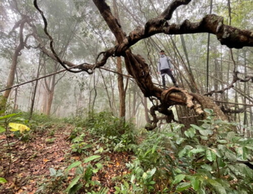
The Pha Dok Siew Nature Trail, nestled within the lush expanses of Doi Inthanon National Park in Northern Thailand, is more than just a trekking path—it’s a journey through the region’s rich cultural tapestry and breathtaking landscapes. Managed by the local Karen community, this trail has been lovingly maintained and recently enhanced to offer visitors a safe yet immersive experience. With improvements funded by a grant commemorating King Rama IX’s coronation and supported by Chiang Mai University, the trail now features sturdy bamboo bridges, wooden staircases, and educational boards that offer insights into the area’s unique flora and fauna. For those seeking an authentic Chiang Mai hiking experience, Pha Dok Siew is a must-visit destination.


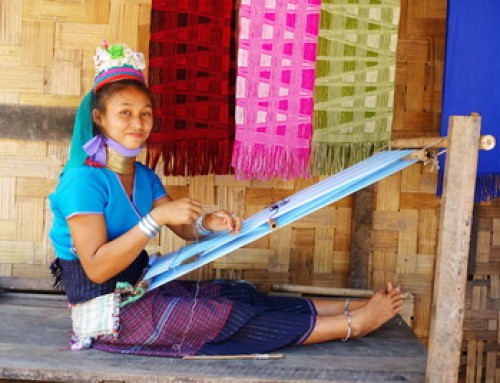
Trekking the Pha Dok Siew Nature Trail is not just about exploring natural beauty; it’s also an opportunity to connect with the local Karen people who have lived in this area since 1870. Their deep-rooted connection to the land is evident in how they’ve designed and preserved the trail. The Karen’s craftsmanship shines through in the bamboo and wood structures that guide trekkers safely through the more challenging parts of the trail, particularly near the majestic Pha Dok Siew Waterfall. Additionally, the educational boards along the trail, placed by the Karen community with the assistance of Chiang Mai University, serve as a testament to their commitment to sharing their knowledge of the local ecosystem.
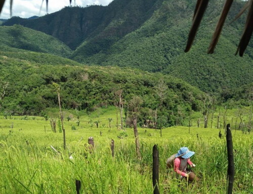
As you embark on your trek, the trail begins with a gentle descent through a dense forest filled with towering pine trees, such as Pinus Kesiya. The cool, crisp air and the serene atmosphere create the perfect setting for a peaceful walk. Along the way, informational boards provide fascinating details about the various plant species and wildlife that call this forest home, enriching your hiking experience. As you continue, the trail leads you to a series of greenhouses brimming with marigold flowers, which hold significant cultural and religious meaning as symbols of worship for the Buddha. This vibrant display of color amidst the greenery hints at the Karen people’s deep spiritual connection to their environment and may also indicate subtle changes in the trail’s route over the years.


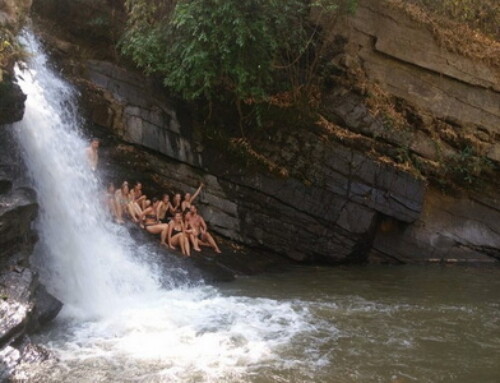
The crown jewel of the Pha Dok Siew Nature Trail is undoubtedly the Pha Dok Siew Waterfall, a stunning cascade that is part of the Mae Klang River. This river, originating from the higher elevations of Doi Inthanon, flows down through a series of breathtaking waterfalls, including the famous Mae Klang, Wachirathan, and Sirithan falls, before merging with the Ping River. The waterfall’s power and beauty are awe-inspiring, and the mist that rises from the crashing water creates a cool, refreshing atmosphere, perfect for a mid-hike break. For those looking to cool off, there is a designated swimming area just below the waterfall. However, swimming is only permitted when conditions are safe, as the local guide will advise, particularly after heavy rainfall. If you decide to take a dip, don’t forget to bring a small towel to dry off before continuing your trek.


After spending time at the waterfall, the trail continues towards Mae Klang Luang Village, a small Karen settlement nestled in the hills. This village, named after the Klang River, which provides the community’s drinking water, is a living testament to the Karen people’s enduring presence in the area. The village is renowned for its agriculture, with the locals cultivating rice, coffee, strawberries, and raising water buffalo. The walk to Mae Klang Luang takes between 90 minutes to 2 hours, depending on your pace, and is a gentle ascent through picturesque landscapes. Upon arrival, you’re greeted with the opportunity to savor locally roasted and ground coffee, a specialty of the village. The rich, aromatic flavor of the coffee, enjoyed amidst the stunning backdrop of rice terraces and mountains, is the perfect way to conclude your trekking adventure.
How to Get There
To reach the Pha Dok Siew Nature Trail, head to Doi Inthanon National Park, located approximately two hours from Chiang Mai city. The trail is easily accessible, but a guide is mandatory for trekking. Hiring a local guide not only supports the community but also ensures a more enriching experience, as they share insights about the area’s history, culture, and natural environment. Numerous tour operators in Chiang Mai offer guided hikes to the Pha Dok Siew Nature Trail, often as part of a full-day tour that includes other attractions in the park.
Our services :
- Trekking Baan Mae Klang Luang – Pha Dok Siew Nature Trail (Join with group tour)
- Elephant Observation and Hiking Doi Inthanon at Pha Dok Siew Nature Trail (Join with group tour)


Leave A Comment