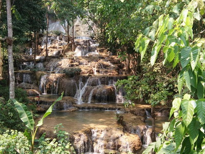
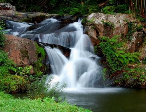
Tham Pha Thai National Park offers spectacular views of waterfalls and caves.

Tham Pha Thai National Park is located between Mueang and Ngao districts, some 60 kilometres from the provincial town. It’s famous for the picturesque stalactite and stalagmites in the Tham Pha Thai cave. There are also several smaller caverns, each with their own attractions. Places of Interest in the Park
Tham Pha Thai National Park covers the areas of Muang District, Jae Hom District, Ngao District of Lampang Province. The topography of the National Park consist of high mountains, abundant timber forests and mixed deciduous forests, as well as teak plantations spreading all over the areas. The National Park is the dwelling place for a large number of wild animals. Most of the areas are water sources. Major tourist attractions include Thamphathai, Lom Phukeaw, Kewlom Reservoir, Tham-okroo, Huay Maepreung. Moreover, there are many small-sized waterfalls all over the National Park, as well as the Young Elephant Training Center, a tourist attraction of the Forest Industry Organization, situated in the approximate area of 1,284.9 square kilometers or 802,436.17 rai.


Geography
The topography of the National Park consist of high mountains, mixed forests, teak plantations and reclaimed areas. Major mountaintops include Doi Kewlom (1,202 meters high), followed by Doi Sanklang (1,022 meters high), Doi Phahuad (975 meters high). Most of the areas are timber forests and mixed forests. Doi Luang (1,100 meters high) is situated in the southern part of the National Park. Major agricultural sites are situated in the eastern part of the National Park, meanwhile, in the western part of the National Park, most of the areas are timber forests. Gullies and streams in the western part of the National Park flow into Wang River, meanwhile, most of the gullies and streams in the eastern part of the National Park flow into Ngao River.
Climate
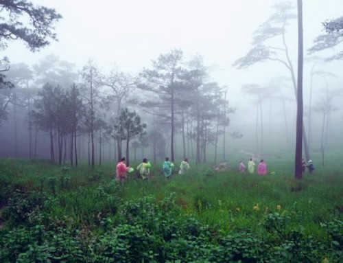
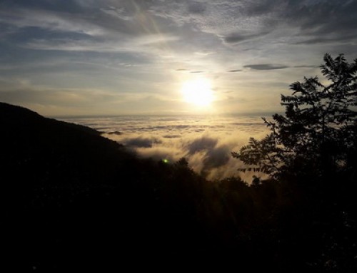
It is extremely hot in summer (March-May) and the wind blows from the southwest. In the rainy season (May-October), meanwhile, it rains consistently and sometimes there are heavy storms and the wind blows from the southwest. In winter (November-February), it is extremely cold in the nighttime and the area is generally covered with fogs in the morning. The cold wind blows from the northeast.


Flora and Fauna
Since the topography of the National Park consist of high mountains, there are various kinds of forests within the area of the National Park, including dense or leafy forests and arid, evergreen forests. Major plants include Malabar ironwood, rubber trees, Lithocarpus cantleyanus (Kor), Indian mahogany, Cinnamon, Gonocaryum lobbianum, etc. Leafy forests include mixed deciduous forests, timber forests. And major plants found in the forests include Leguminosae (Pradoo), Afzelia xylocarpa Roxb (Maka Mong), Xyliaxylocarpa (redwood plants), Lannea coromandelica (Oay Chang), Dalbergia oliveri Gamble (Ching Chan), different kinds of bamboo, Mitragyna diversi Folia (Toom Gwow), Hymenodictyon excelsum (U-lok), Combretum quadrangulare (Sa-gae), Bermuda grass, etc.
Wild animals found in the National Park include gaur, wild boars, monkeys, porcupines, moles, masked palm civets, bamboo rats, wild rabbits, different kinds of birds, reptiles such as ground lizards, chameleons, wild geckos, different kinds of snakes, and amphibians such as frogs, small green frogs, bullfrogs, toads, and different kinds of fish.


Tourist Attractions at Tham Pha Thai National Park
- Phathai Cave: Thamphathai originated from a limestone mountain at the depth of 405 meters from the cave entrance. Thamphathai has beautiful stalagmites and stalactites along the walking paths, attracting a lot of Thai and foreign tourists. Thamphathai is located at km 665 of Highway No. 1 (Phaholyothin Road). Tourists may access the cave by taking a laterite branch road for approximately 600 meters. The park has installed an electric system to facilitate a walk to see plentiful stalagmites and stalactites within the cave. King Rama VII visited the cave in 1926 and his royal initials “Por Por Ror” were inscribed inside. This cave is also a home to thousands of bats too.
- Huai Tadnoi Waterfall: Huai Tadnoi Waterfall is a small-sized waterfall with the flowing clear water throughout the year, situated in the area of Ban Huai Pong, Jaehom District, Lampang Province. The waterfall can be accessed by car approximately 25 km from Lampang-Jaehom Road.
- Lomphukeaw: Lomphukeaw is a hilltop basin situated within an approximate area of 1-2 rai and having its shape like a volcanic vent. The basin has very deep, greenish water and there is a good deal of fish living in there. Forests within the area of Lomphukeaw are arid, evergreen forests, where a good number of wild animals live in. Lomphukeaw is situated approximately 14 km away from the route of Lampang-Phayao (Highway No. 1 or Phaholyothin Road), where there is a laterite branch road to Ban Onn of Ngao District, Lampang Province. From Ban Onn, tourists may travel on foot for approximately 3.5 km to get to Lomphukeaw.
- Maekae Waterfall: Maekae Waterfall is a small-sized waterfall, originated from Maekae Gully, situated in the area of Ban Maekae, Ngao District, Lampang Province, where tourists can access by car for approximately 18 km from Ngao District.
- Thamratchakreu: Originated from a limestone mountain, Thamratchakreu has beautiful stalagmites and stalactites. Thamphathai is located nearby Ban Maekae, Ngao District, Lampang Province. Tourists may access the cave by taking the route from Ngao District to Ban Maekae for approximately 21 km and by walking for approximately 300 meters into the cave.
- Kiw Lom dam lake on Vang river offers boat excursion, and raft houses to stay. The lake is around 34 km north of Lam Pang city.
- Tham Chon is a small cave with three chambers each decorated with a curtain of stalactites. It has been told that it was a cave of thieves or ‘Chon’ in Thai. It can access by foot from Tham Pha Thai.
- Namtok Mae Chaem Fa or Namtok Tat Moei is around 8 km along the road from Mu 1, Ban Thung Hang, Tambon Thung Phueng, Amphoe Chae Hom. The waterfall has clear and clean water flowing through its nine tiers. Each tier is beautiful with emerald green cascades, which is a specific feature of a waterfall on a limestone mountain.
- Ban Huai Hok Pre-historic Paintings depict a file of marching people that are believed to have been there for 2,000-3,000 years. Such red paintings belong to a nomadic society and are rarely found in Thailand. The painting site is around 3.5 kilometers from Muban Huai Hok (Huai Hok Village), and can be accessible on foot.
How to get there
Tham Pha Thai National Park is situated at km 665-666 (approximately 65 km away from the city of Lampang to Phayao Province). You may take Highway No. 1 (Lampang-Chiang Rai) or the route of Prae-Ngao-Chiang Rai (before reaching Ngao District, make a left hand turn to Lampang Province and go straight on for approximately 15 km) to get to the Headquarter National Park. If you do not have car, you can contact us to arrange the private tour package which suitable for your group.
Opening hours and Entrance fee : Opens daily from 8 am until 6 pm. Admission is THB 100 per adult and THB 50 per child and THB 30 per car.
Note : Not accessible for wheelchair user
Our services :

Tham Pha Thai National Park Map


Leave A Comment