Tham Pla – Namtok Pha Suea National Park is in Pang Mappha and Mueang of Mae Hong Son Province.
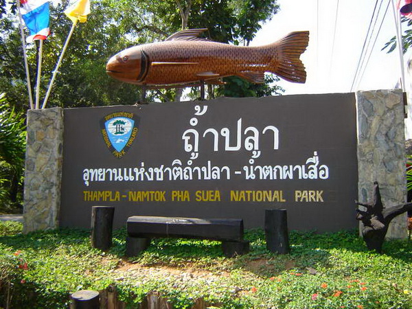
Explore the rich biodiversity, stunning landscapes, and cultural landmarks of Tham Pla – Namtok Pha Suea National Park in Mae Hong Son Province.
Tham Pla – Namtok Pha Suea National Park is one of Mae Hong Son Province’s most remarkable natural attractions. Covering an area of 630 square kilometers, this national park is a perfect blend of untouched nature, diverse wildlife, and cultural significance. Nestled in the Daen Lao Mountain Range, this region is characterized by steep mountain peaks, deep valleys, and dense forests, making it a paradise for nature lovers, trekkers, and adventure seekers.
This national park is renowned for its stunning waterfalls, mystical caves, and abundant biodiversity. It is also deeply connected to local Thai and Burmese cultures due to its close proximity to the Myanmar border. The park’s most famous attractions include the sacred Tham Pla (Fish Cave), the breathtaking Pha Suea Waterfall, and several scenic hiking trails that immerse visitors in lush greenery.
Visitors can explore a variety of landscapes, from pine forests and rocky cliffs to serene rivers and waterfalls, while also spotting rare wildlife. Whether you’re looking for adventure, relaxation, or cultural immersion, Tham Pla – Namtok Pha Suea National Park is a must-visit destination in northern Thailand.
Geography and Climate
Mountainous Terrain
The park is located in the Daen Lao Range, an ancient mountain range that extends into Myanmar. The highest peak, Doi Lan, stands at 1,918 meters above sea level, offering panoramic views of Mae Hong Son’s rolling hills and dense forests. The terrain here is characterized by limestone cliffs, deep valleys, and gushing streams, making it a diverse and rugged natural wonder.

Climate and Best Time to Visit
The park experiences three main seasons, influenced by the tropical monsoon climate:
- Rainy Season (May to October): Heavy rainfall nourishes the forests and waterfalls, making it the best time to witness Pha Suea Waterfall at full strength.
- Cool Season (November to January): This is the most popular time to visit, with pleasant temperatures ranging from 10–20°C, clear skies, and fresh mountain air.
- Hot Season (February to April): The forest remains lush, but daytime temperatures rise above 30°C, making early morning or late afternoon explorations ideal.
The best time to visit is between November and February, when the weather is cool and the natural scenery is at its most vibrant.
Flora and Fauna
Diverse Ecosystems
The park is home to several types of forests, including:
✔️ Mixed Deciduous Forests – Home to teak, Xylia xylocarpa, and bamboo species.
✔️ Pine Forests – Featuring Pinus kesiya and Pinus merkusii, creating a unique, high-altitude ecosystem.
✔️ Evergreen Forests – Providing shade and shelter for diverse wildlife.
Wildlife Inhabitants
The rich habitats support a plethora of wildlife, including:
The park is teeming with wild animals and bird species, including:
✔️ Mammals: Gaur, goral, barking deer, wild boars, and serows.
✔️ Birds: Hornbills, kingfishers, woodpeckers, and rare pheasants.
✔️ Aquatic Life: The sacred Soro Brook Carp, found in Tham Pla (Fish Cave).
For wildlife enthusiasts, the park offers opportunities to spot rare species while enjoying the tranquil surroundings of Mae Hong Son’s pristine nature.
Tourist Attractions at Tham Pla – Namtok Pha Suea National Park

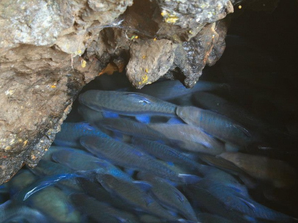
Tham Pla or Fish Cave
Pla Cave or Fish Cave: Tham Pla is a hillside cave with the flowing water throughout the year. You can watch a large school of blue-black fish called “Soro Brook Carp” or “Labeobarbus Soro”. Tham Pla also has beautiful scenery of forests, cliffs, and limestone mountains.
Pha Sua Waterfall
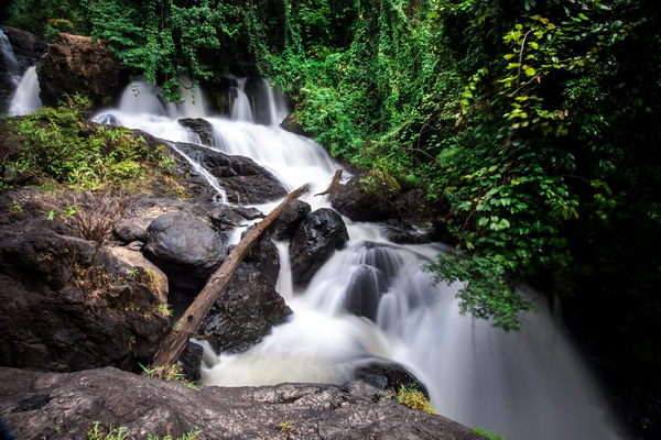
Pha Sua Waterfall: A picturesque waterfall approximately 10 meters high and 15 meters wide. It’s especially stunning during the rainy season when the water flow is at its peak. The name “Pha Suea” translates to “mat,” reflecting the waterfall’s appearance as it cascades over the rocks.
Huay Pong-on Waterfall: The Waterfall is situated between the access road to Huay Pong-on village. The Waterfall is approximately 7 meters high and 5 meters wide and having the flowing water throughout the year. The Waterfall also has beautiful scenery and a small basin of 40 square meters for swimming.
Mae Sa-nga Klang Waterfall: Mae Sa-nga Klang Waterfall is a beautiful waterfall situated above Mae Sa-nga Dam, with the flowing water throughout the year. The Waterfall is approximately 15 meters high and 10 meters wide, and can be easily accessed by walking or by boat.
Pang Ung
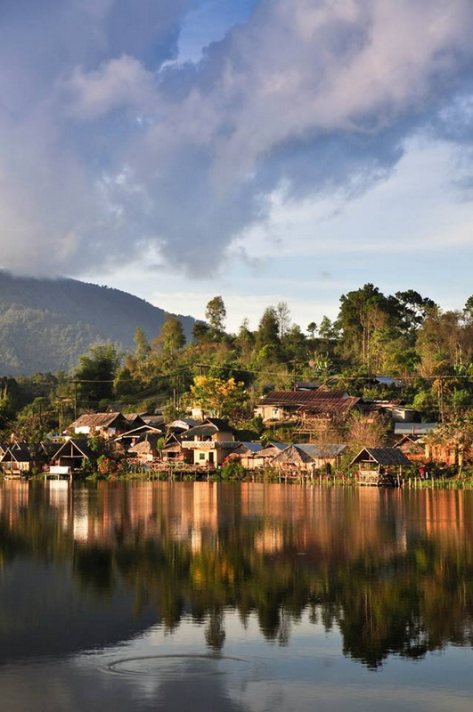
Pang Ung is one of the Royal Initiative projects by HM Queen Sirikit for highland development. A large reservoir in Pang Ung is popular and attracts more and more visitors to come every year. Its lake view, pine leaves, beautiful mountain scenes, and hazy fog in the morning are a perfect combination for visitors who love to touch by natures. Surrounded by a verdant pine forest, the lake is beautiful in every season. Walking or Jogging along the lakeside are pleasant activities to do. There are camping areas and guesthouses around the lake. Pang Ung sometimes is called “Switzerland in Thailand”. In the winter, sometimes the temperature drops to zero and create a thin film of ice covered flowers and plants.
How to get there
To get to the headquarters drive from Mae Hong Son town on highway 1095 around 20 km to the north. There is a left turn-off road to the park entrance.
Tham Pla – About 17 kilometres from town on Highway No. 1095 (Mae Hong Son-Pai), Tham Pla is a popular attraction of Mae Hong Son. The surrounding areas are brooks and cool hilly forests suitable for relaxation. A special feature is the hollow cave filled with numerous freshwater fish known as Pla Mung or Pla Khang, which is of the same family as the carp. The fish are quite safe from being caught as they are believed to belong to the gods.
Namtok Pha Suea – This waterfall is in Tambon Mokchampae about 26 kilometres from the provincial seat on Route 1095 to Pai district with a left turn at Km. 191. It is a large fall with its water source in Myanmar and runs full during the late rainy season (August-September).
Facilities in the park
✔️ Visitor Center – Provides maps, park information, and staff assistance.
✔️ Parking Areas – Available at the main attractions for convenience.
✔️ Restrooms & Changing Rooms – Well-maintained facilities for visitors.
✔️ Camping Grounds – Offers tent rentals for those wanting to stay overnight.
✔️ Picnic Spots – Scenic areas with tables and shaded seating.
✔️ Food Stalls & Shops – Selling local food, drinks, and souvenirs.
Contact address
Tham Pla – Namtok Pha Suea National Park
Mok Cham Pae, Mueang Mae Hong Son District
Mae Hong Son 58000, Thailand
Phone: +66(0) 53 619 036
Entrance fee
100 baht for adults and 50 baht for children
Open daily
from 8.00 a.m. to 18.00 p.m.
Our services :

Tham Pla – Namtok Pha Suea National Park Map
Nearby Attractions
Su Tong Pae Bridge
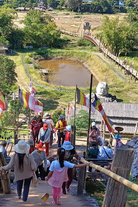
Su Tong Pae Bridge : One of Thailand’s longest bamboo bridges, Su Tong Pae Bridge stretches over lush rice fields, connecting a local temple with a nearby village. Built by monks and villagers, it is a symbol of faith and unity. The bridge is particularly beautiful at sunrise and sunset.










Leave A Comment